Off the Beaten Path: Hidden Trails & Tales Around Kootenai, Idaho
You don’t have to go far from your front porch in the City of Kootenai to find fresh air, big views, and trails that’ll remind you why you live here—or make you wish you did.
Now, we ain’t talkin’ about the packed parking lots at Schweitzer or the selfie stations at Sandpoint City Beach. We’re talking about the little-known spots. The kind of trails you won’t find in a travel blog or glossy brochure. These are the ones your neighbor tells you about over a fence post, or your uncle shows you with a paper map he’s had folded in his glove box since 1982.
1. The Old Railroad Grade Trail
Location: Just outside Kootenai city limits, heading northeast
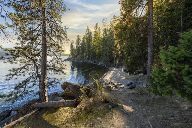
What used to be part of the old Northern Pacific spur line has turned into a locals-only walking and biking trail. It runs parallel to the tracks and gives you a flat, easy stretch with sneak-peek views of the Cabinet Mountains and occasional deer crossings. It’s peaceful, it’s shady, and there’s a good chance you’ll see more dogs than people.
Local tip: Hit it at golden hour and you’ll swear the sky is trying to impress you.
2. The Powerline Ridge Cut
Location: North edge of Kootenai, behind the industrial yard
No, it’s not on any map. And yes, it’s technically a utility easement. But if you’re up for a bit of brush-crunchin’ and don’t mind a slight uphill grind, you’ll be rewarded with one of the best unmarked overlooks of the valley. Locals use it for sledding in winter and beer-in-hand sunset hikes in summer.
Bring bug spray. Trust us.
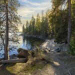
3. The Quiet Spot by the Kootenai Wildlife Corridor
Location: South end of Kootenai, off Lincoln & Fourth
A short footpath cuts from town toward the wooded corridor that backs up against the east edge of Sandpoint’s city limits. If you stay quiet, you’ll see osprey, hawks, and maybe even a moose taking a slow stroll through the brush. It’s not maintained—but that’s kind of the point.
Perfect place to sit with a thermos and a thought.
4. Hidden in Plain Sight: The “Back Way” to Schweitzer Creek
Location: East side of town, follow the gravel past the old grain silo
There’s a backdoor trail through old timber roads that’ll link you to the edges of Schweitzer Creek drainage. It’s rugged and muddy, and you’ll probably end up with pine needles in your socks—but it’s worth it. You’ll cross little seasonal creeks and see signs of critters most folks miss while they’re stuck in town traffic.
Use your head: no signs, no cell service, and no one to save you if you twist an ankle. Go with a buddy.
More Than Just a Trail… It’s a Story
These aren’t just walks in the woods. They’re part of what makes Kootenai, Idaho special. This isn’t a big town. We like it that way. When you find something out here, it feels like it’s yours—even if it’s been there a hundred years.
Whether you’re walking the dog, escaping the kids, or chasing the peace that comes after a long day, you don’t need to go far to find it. Just step off the pavement.
Want to Add to the List?
We know you’ve got your own secret spot. The one you don’t tell out-of-towners about. Want to share it with your neighbors?
Email us or stop by City Hall — we’d love to feature your trail tale in the next one.
References:
Pend d’Oreille Bay Trail
- Location: Access points in Sandpoint and Ponderay, just west of Kootenai
- Distance from Kootenai: Approximately 2 miles
- Trail Details: This scenic trail offers a gentle, lakeside walk along Lake Pend Oreille, stretching about 1.5 miles one way. It’s ideal for walking, jogging, and wildlife viewing.
- More Information: Visit North Idaho – Hikes & Walks
Trailforks
Visit North Idaho+1Visit North Idaho+1
Mickinnick Trail
- Location: Trailhead on Woodland Drive, Sandpoint
- Distance from Kootenai: Approximately 5 miles
- Trail Details: A more challenging hike, this 3.5-mile trail ascends over 2,000 feet, offering panoramic views of Sandpoint and Lake Pend Oreille.
- More Information: AllTrails – Mickinnick Trail
Just Go Travel Studios
Visit North Idaho+1AllTrails.com+1
Schweitzer Mountain Trails
- Location: Schweitzer Mountain Resort, northwest of Kootenai
- Distance from Kootenai: Approximately 12 miles
- Trail Details: During the summer months, Schweitzer offers a network of trails suitable for hiking and mountain biking, ranging from easy loops to more strenuous climbs.
- More Information: Schweitzer Summer Activities
AllTrails.com+1US Forest Service+1
Kootenai National Wildlife Refuge Trails
- Location: Near Bonners Ferry, Idaho
- Distance from Kootenai: Approximately 35 miles
- Trail Details: The refuge features several short trails, including the Myrtle Falls Trail (0.9 miles round trip) leading to a picturesque waterfall, and the Deep Creek Trail (2.2 miles), offering wildlife viewing opportunities.
- More Information: U.S. Fish & Wildlife Service – Kootenai National Wildlife Refuge
Traillink+24Trailforks+24idahoconservation.org+24
Wikipedia+11Wikipedia+11INLAND NW ROUTES+11
INLAND NW ROUTES+1AllTrails.com+1
U.S. Fish and Wildlife Service
Mineral Ridge National Recreation Trail
- Location: East of Coeur d’Alene, Idaho
- Distance from Kootenai: Approximately 45 miles
- Trail Details: This 3.3-mile loop trail offers a moderately strenuous hike with rewarding views of Lake Coeur d’Alene. It’s a popular spot for both locals and visitors.
- More Information: Wikipedia – Mineral Ridge National Recreation Trail
Visit North Idaho
Wikipedia+1Visit North Idaho+1
Trail of the Coeur d’Alenes
- Location: Stretching from Plummer to Mullan, Idaho
- Distance from Kootenai: Nearest access point approximately 30 miles away
- Trail Details: A 73-mile paved trail suitable for biking, walking, and wildlife observation. The trail passes through diverse landscapes, including wetlands, forests, and historic towns.
- More Information: Wikipedia – Trail of the Coeur d’Alenes